For the first time, the parade ground of the Toulon naval base — a space historically off-limits to scientific scrutiny — is undergoing an unprecedented archaeological intervention. This operation, the first of its kind within the military complex, acts as a powerful probe that pierces temporal layers to expose a continuous historical sequence, from the settlements predating the foundation of the Roman agglomeration of Telo Martius — in the second half of the 1st cent…
For the first time, the parade ground of the Toulon naval base — a space historically off-limits to scientific scrutiny — is undergoing an unprecedented archaeological intervention. This operation, the first of its kind within the military complex, acts as a powerful probe that pierces temporal layers to expose a continuous historical sequence, from the settlements predating the foundation of the Roman agglomeration of Telo Martius — in the second half of the 1st century CE — to the occupation of the island by the Royal and later National Navy from the late 17th century onward.
The catalyst for this window into the past is the project to adapt the port infrastructures to receive and maintain the French New Generation Aircraft Carrier (PA-NG project), scheduled to enter service in 2035.
The area under investigation, known as Milhaud, was not always dry land. Until its annexation to the coast in the 1930s, it formed a small island — a geographical feature whose strategic position has influenced its use throughout the centuries. The oldest remains located by teams from the National Institute for Preventive Archaeological Research (Inrap) trace human occupation of this place back to a period of conquest and cultural transition around the 2nd century BCE, when Gallic, Greek from Massalia, and Roman cultures converged and traded along this sector of the Mediterranean coast.
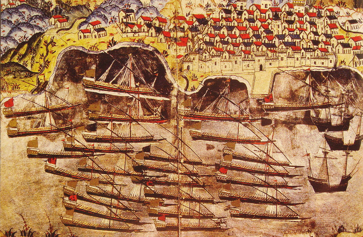 The Ottoman fleet wintering in Toulon. Credit: Public domain / Wikimedia Commons
The unearthed structures, covering several thousand square meters, suggest a complex that combined, at least between the 2nd century BCE and the 2nd century CE, residential functions with others linked to craftsmanship, fishing, and trade. The solidity of the uncovered walls is complemented by abundant and significant movable material, including sets of ceramics and coins that map out the trade networks of the time.
The provenance of these objects, with a marked presence of products originating from southern Italy, confirms the integration of this enclave into the commercial dynamics of the western Mediterranean. The numismatic analysis of the coins recovered so far has led to a hypothesis of considerable significance: the possible existence of a minting workshop on site — a theory that will need to be confirmed or ruled out as excavation progresses.
The landscape of Milhaud Island underwent a radical transformation from the last third of the 17th century, when the French Royal Navy decided to install a powder magazine there. This institutional decision marked a turning point, permanently establishing the site’s military vocation for supplying and arming the French fleet. The powder magazine, one of the few surviving examples of its time, has drawn attention — but the most striking discovery from an architectural perspective lies at its base: a monumental quay, preserved in an exceptional state for nearly eighty linear meters within the excavated area.
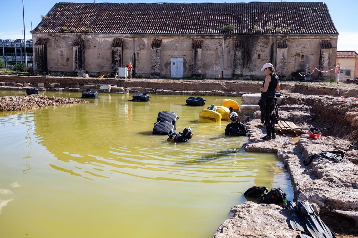 The Milhaud powder magazine (17th century) and its pier undergoing underwater excavation by INRAP diving archaeologists. Credit: Flore Giraud, Inrap
This quay was the key infrastructure for the logistical operations of the powder magazine; ships carrying gunpowder and ammunition for the vessels moored in various port areas of the arsenal or in the small roadstead of Toulon docked there.
The meticulous study of its construction, its foundation system — which includes wooden piles — and its annexed elements such as stairways or lifting structures will provide essential data on military port engineering of the period. Moreover, the seabed adjacent to the quay serves as a time capsule with a dual archaeological potential: it may contain remains linked to the quay’s daily activities — fragments of boats, ropes, tools, or everyday ceramics — or even older evidence sealed and protected by the construction of the mooring area itself.

Subscribe to our newsletter
Receive our news and articles in your email for free. You can also support us with a monthly subscription and receive exclusive content.
The site’s geographical and historical uniqueness, as a former island separated from the mainland by an arm of the sea, required an equally unique working methodology, synchronizing terrestrial and underwater archaeological techniques. Although the sector designated as Milhaud 7 is now filled and reclaimed land, the marine water table surfaces barely one meter below ground. Faced with this condition, and aiming to study the quay in its full vertical height and the adjacent port space, the Inrap archaeologists opted for an ingenious solution: instead of fighting the water infiltration, they decided to enhance it.
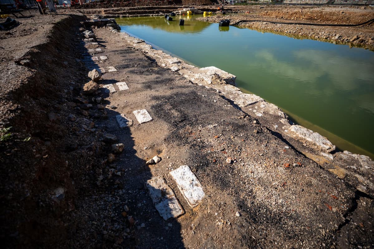 The Milhaud powder magazine pier cleared of the 1930s embankment and returned to the water for the purposes of excavation. In the foreground, the remains of the railway installed in the 19th century. Credit: Flore Giraud, Inrap
A vast basin was excavated in the 1930s landfill, allowing controlled flooding of the area. In this way, diver-archaeologists could take over from their terrestrial colleagues, continuing the excavation below the water’s surface in an environment that recreates the original conditions of the sea channel.
This intervention at the naval base is not an isolated event within the PA-NG project context. The development of new infrastructures, which also includes operations in the small roadstead’s water area, has prompted other preventive archaeological surveys currently managed by the Department of Underwater and Submarine Archaeological Research (Drassm).
The future industrial-port zone, to be built west of the current Milhaud docks, aims to consolidate Toulon’s position as Europe’s leading military port, a status that — as the findings demonstrate — is rooted in a strategic and productive relationship with the sea stretching back more than twenty-two centuries.
The execution of this archaeological work falls under the Defense Infrastructure Service (SID), operating under the Secretary General for Administration of the Ministry of the Armed Forces, which acts as the reference operator for the construction and maintenance of the Ministry’s real estate assets.
From a scientific standpoint, the capacity to respond to interventions of such complexity is provided by the Inrap’s Underwater Unit — a specialized division composed of around fifteen archaeologists and experts trained to work in aquatic environments, from the land-water interface to depths that in some cases require the use of robotic dives.
Their work focuses on studying the remains of human activity in rivers, lakes, and seas, contributing to reconstructing the complex and always decisive relationship that societies have maintained with their aquatic environment.